Historical Figures
Learn more about some of the historical figures who lived, worked, and left their mark in Clementi:
-
Sir Cecil Clementi Smith (1840-1916) was the governor and commander-in-chief of the Straits Settlements from 1887 to 1893. A popular governor, Sir Cecil Clementi Smith was known to have established the Queen’s scholarships and limited the power of secret societies. According to the 2023 edition of “Singapore Street Names: A study of Toponymics” and a 2015 Straits Times article entitled “Making a historical connection in Clementi” (available for viewing at the libraries), Clementi Road and Clementi Town was named after Sir Cecil Clementi Smith.
-
Sir Cecil Clementi (1875-1957) was the governor of the Straits Settlements from 1930 to 1934 and was Sir Cecil Clementi Smith’s nephew. In contrast to his uncle, Sir Cecil Clementi was relatively unpopular with the locals due to his efforts to suppress the vernacular press; supress anti-colonial activities; and the ceasing of educational grants for Chinese and Tamil vernacular schools. Despite this, he was viewed favourably by the colonial press for his contributions. This led to an alternative suggestion that Clementi Road was named after him, which S. Ramachandra has suggested in a Singapore Standard newspaper article entitled “The Naming of Streets” in 1952.
-
Which Straits Settlements governor was Clementi actually named after? The Rural Board decision to rename Reformatory Road was made on 16 October 1947 and published the next day by the Singapore Free Press, on 17 October 1947, in article entitled “Properties will be re-assessed.” The article makes no mention of the reasoning behind the name change; nor does it mention which Straits Settlements governor was being referred to; however, it mentions that the road was renamed following the renaming of the Singapore Reformatory to that of Bukit Timah Home.
-
Sir Franklin Charles Gimson (1890-1975), Singapore’s first postwar governor and commander-in-chief from 1946 to 1952, lent his name for the Gimson School for Boys, a home for delinquent boys, which used to be located along Clementi Road. Sir Gimson was often associated with the rehabilitation of postwar Singapore, the reconstitution of Singapore’s legislative bodies, and the introduction of the Income Tax Ordinance.
-
Yusof bin Ishak (1910-1970) was the Yang di-Pertuan Negara when he officially opened the Tentera Diraja Mosque near Clementi Road in 1962. He later became Singapore’s first president and his portrait appears in Singapore’s portrait series currency notes, which were first released in 1999.
Significant Events
Discover some notable moments in Singapore’s history that happened in Clementi:
-
Clementi New Town was partially built on the former Colombo Camp, a military camp. In 1947, several hundred Ceylonese Pioneers rioted over food quality at Colombo Camp. Eight members of the Royal Pioneer Corps (Ceylonese Section) were later put under detention over the matter.
-
Ngee Ann Polytechnic was built on top of a former Teochew burial ground named Guang Shou Shan (广寿山), which was administered by the Ngee Ann Kongsi. The unclaimed remains of the exhumed graves were cremated and stored at the Teochew Memorial Park, in Yishun.
-
The bomb disposal unit of the Singapore Armed Forces has been called to Clementi on three separate occasions. The first instance occurred in April 1981, when a grass cutter discovered a grenade near Clementi Avenue 3. The second incident took place in August 1990, when a young boy found a grenade along a canal and placed it at the void deck of Clementi Avenue 5. The grenade was subsequently detonated between Commonwealth Avenue West and Clementi Road. The third callout was in March 2009, when a World War II bomb was found at the construction site of Casa Clementi in Commonwealth Avenue West.
-
The first MRT major accident on the Mass Rapid Train system occurred at Clementi on 5 August 1993. The accident, which was a front-to-back collision between two trains caused by a technical fault, resulted in 156 injured commuters.
Clementi Map
Explore maps of Clementi to see visual representations of the area over the years:
-
1953 Topographic Map, Singapore Provisional Issue
-
1975 Survey Map, Pandan Mukim
-
1978 Topographic Map, Singapore. Queenstown.
-
1984 Survey Map, Singapore Road Map – South West
-
1999 (24) Electoral Map for West Coast Group Representation Constituency (GRC), Map 1 of 2
Streets
Learn more about some of the streets that run through the Clementi area:
-
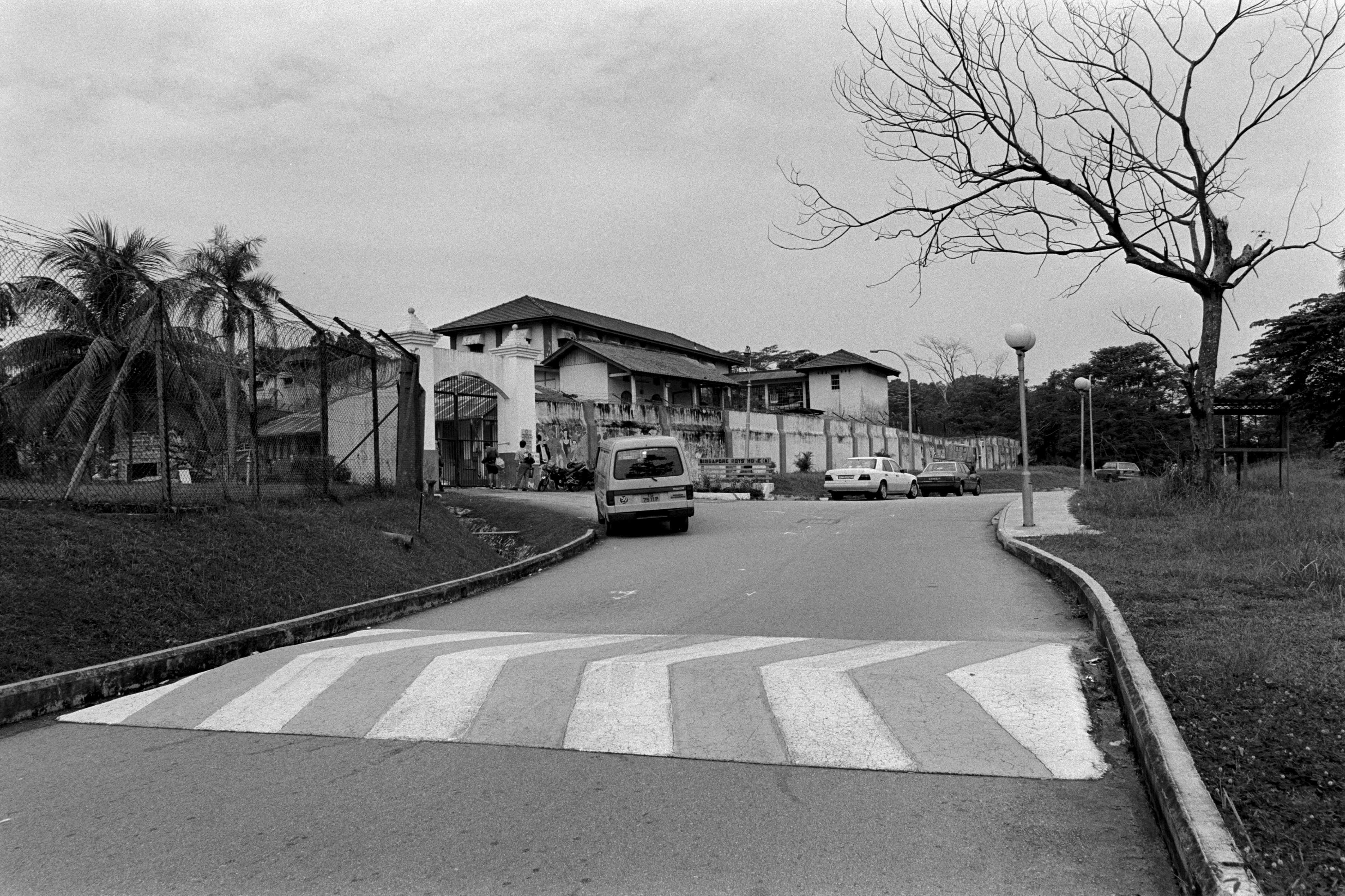
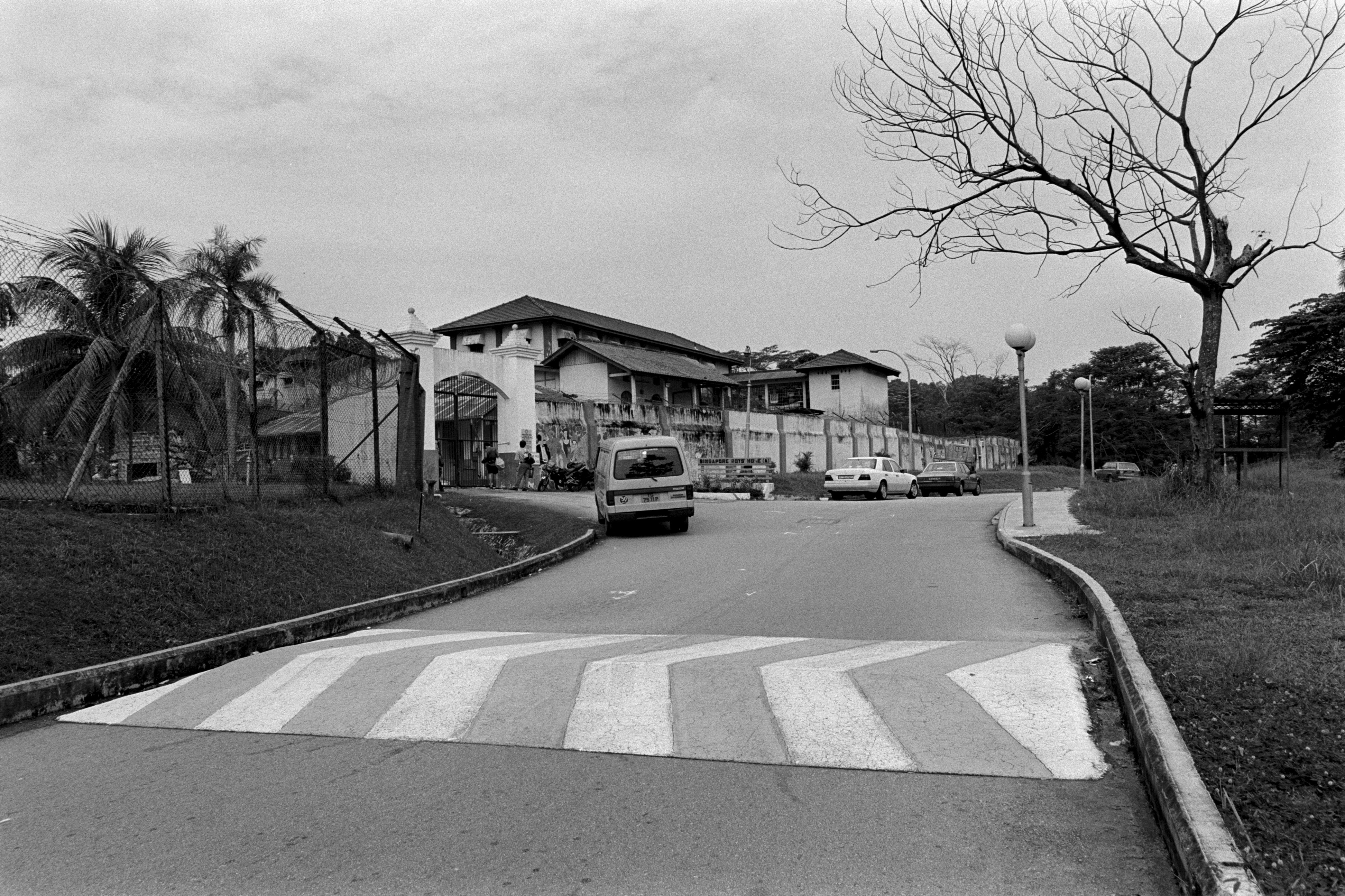
The oldest road in the Clementi district is a road that is now called Clementi Road, which links from Bukit Timah Road to Pasir Panjang Road. Until October 1947, Clementi Road used to be called Reformatory Road as there used to be a reformatory school there for juvenile delinquents. The most famous visitor to the Singapore Reformatory School was English comic actor Charlie Chaplin, who visited the boys in 1936. During the Japanese invasion in February 1942, Reformatory Road (now Clementi Road) was one of the defense lines for the Malay Regiment in the battle for Pasir Panjang.
-
The Ayer Rajah Expressway (AYE) was built in 1988 and spans from the Marina Coastal Expressway (MCE) to Tuas in the west, connecting Clementi, West Coast, and Bukit Merah. It is connected to the Tuas Second Link, which provides an alternative route to Johor in Malaysia.
Clementi Road, Old Reformatory : general view [3]. Lee Kip Lin collection, National Library, Singapore. View this image here.
About National Library Board
The National Library Board (NLB) nurtures Readers for Life, Learning Communities and a Knowledgeable Nation by promoting reading, learning and history through its network of 28 libraries, the National Library and the National Archives of Singapore. NLB also forges strategic partnerships that encourage awareness, appreciation and greater discovery of Singapore’s history through its rich collections on Singapore and the region.


.ashx)

