Image size: 58.0 x 79.0 cm
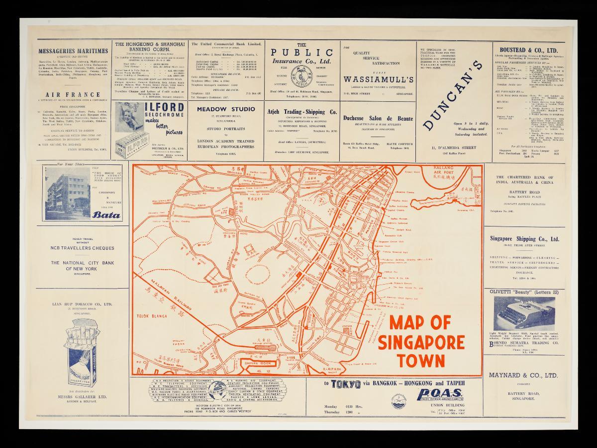
This pull-out tourist map from the late 1940s is likely detached from an edition of ‘The Pocket Plan of Singapore Town’, a series of pocket plans printed by the Union Insurance Society of Canton, Ltd (UISC). These pocket plans were likely meant for UISC’s clients, many of whom would have been business individuals who came to Singapore. The map covers the central south area of Singapore, stretching from Telok Blanga to the outskirts of Kallang Airport, with more detailed focus on the civic district. Prominent tourist landmarks such as the Padang, Raffles Hotel, Supreme Court, Raffles Museum and Capitol Cinema are pointed out. In addition, major roads closer to the present-day Chinatown area such as Havelock Road, New Bridge Road, Kim Seng Road and Outram Road were indicated in both their English and Chinese names. Surrounding the map is a series of advertisements catered to the business traveler: banking and trading services, tailoring, and even air travel services such as Air France and Pacific Overseas Airlines (Siam) Ltd, reconstituted today as Thai Airways. What is notable is that the Singapore offices of many of these firms were located within the Union Building, where the UISC was housedThe UISC started as an insurance company in 1835 for commercial cargoes in Canton, and then gradually expanded to Singapore. By 1920, it was considered the largest marine insurance company in the world. The Singapore branch of UISC was housed at the Union Building on Collyer Quay since 1925, until its demolition in the 1980s.


