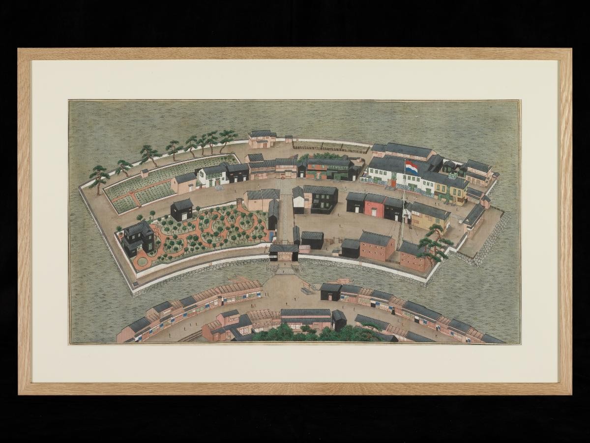
Title
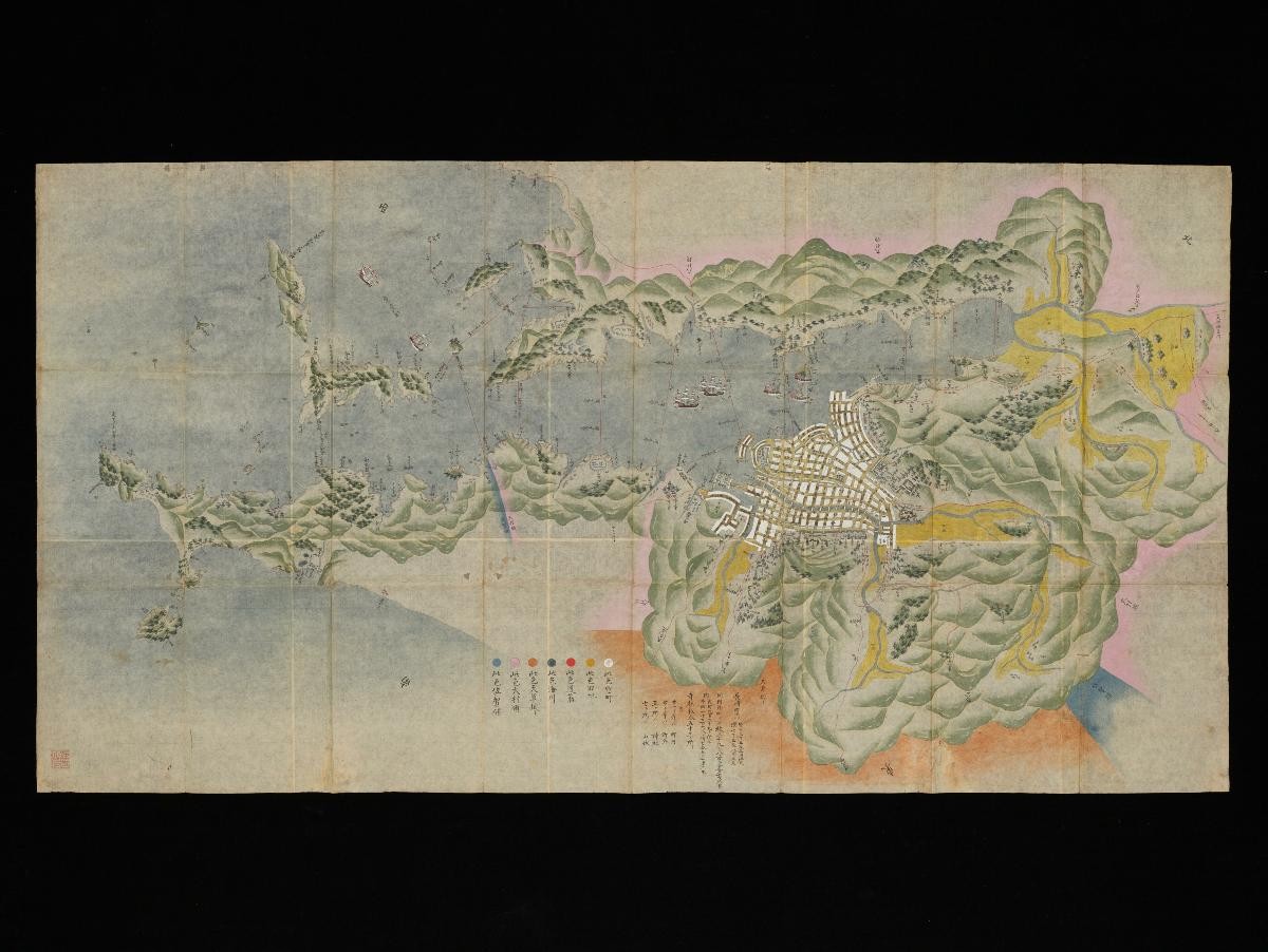
A manuscript plan of the town and bay of Nagasaki
Year/Period
mid 18th century
Region
Japan
Object Type
Material
Technique
Dimension
Image size: 66.0 x 127.1 cm
Accession No.
2020-00053
Collection of
This map shows town and bay of Nagasaki, including Dutch trade post on Deshima Island, and Tojin, the Chinese trade post in the harbour. Names of streets and houses are included, as well as the main shrine, temples, and administrative buildings. Nagasaki grew to be one of the most important cities in Japan by the late 17th century. Dejima was built in 1634–36, for the Portuguese traders; after they were expelled in 1639, the Dutch took their place. The profits of international trade brought considerable wealth to the city. Also, through trade, Western ideas and technology began to infiltrate Japanese society in areas such as education, medicine, and science.