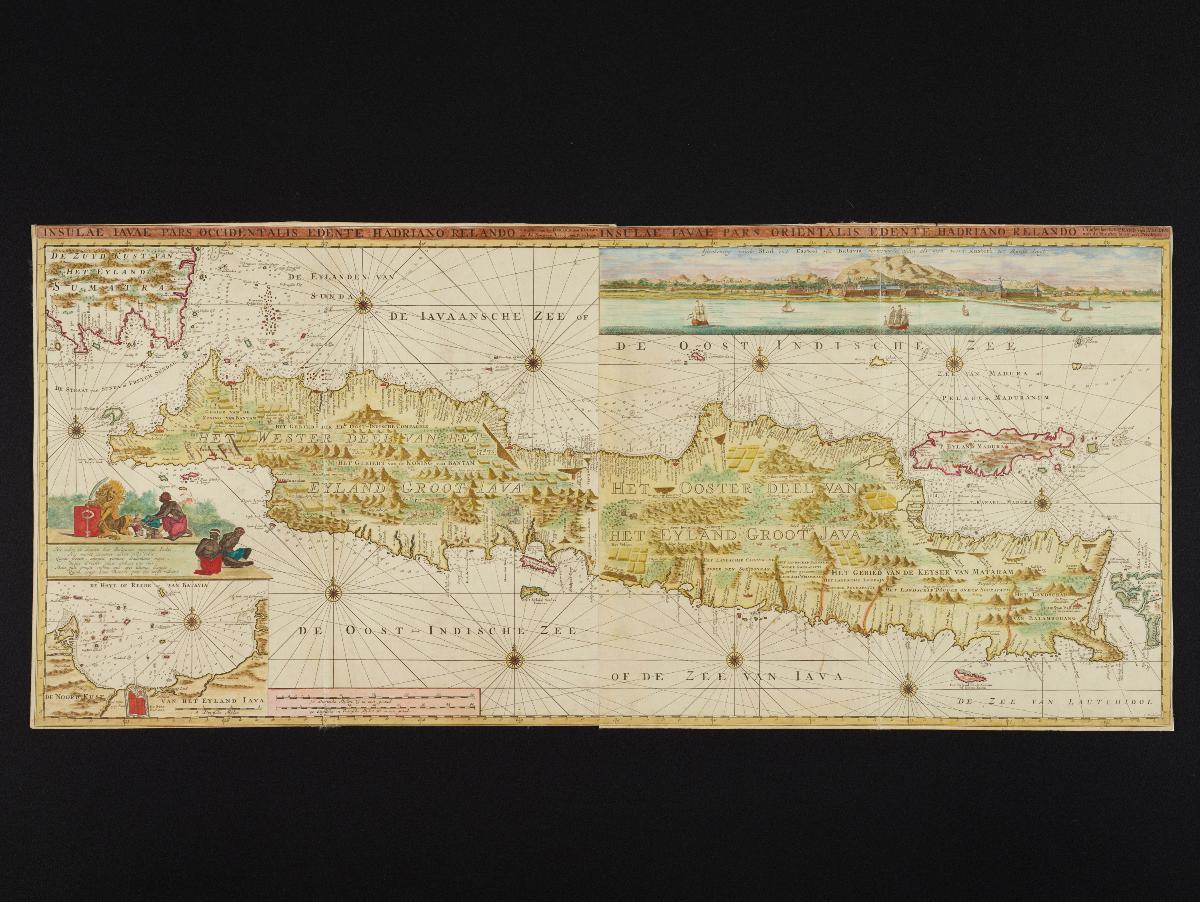
This two-part map of Java was produced by Gerard van Keulen, an engraver, mathematician and hydrographer for the Dutch East India Company. It was published later by his son Johannes van Keulen II in Part VI of his collection of sea charts, the Zee Fakkel, in 1653. Apart from the main map which shows both West and East Java, the insets provide a map and view of Batavia.


